Updated soil phosphorus mapping now available in FORAGE
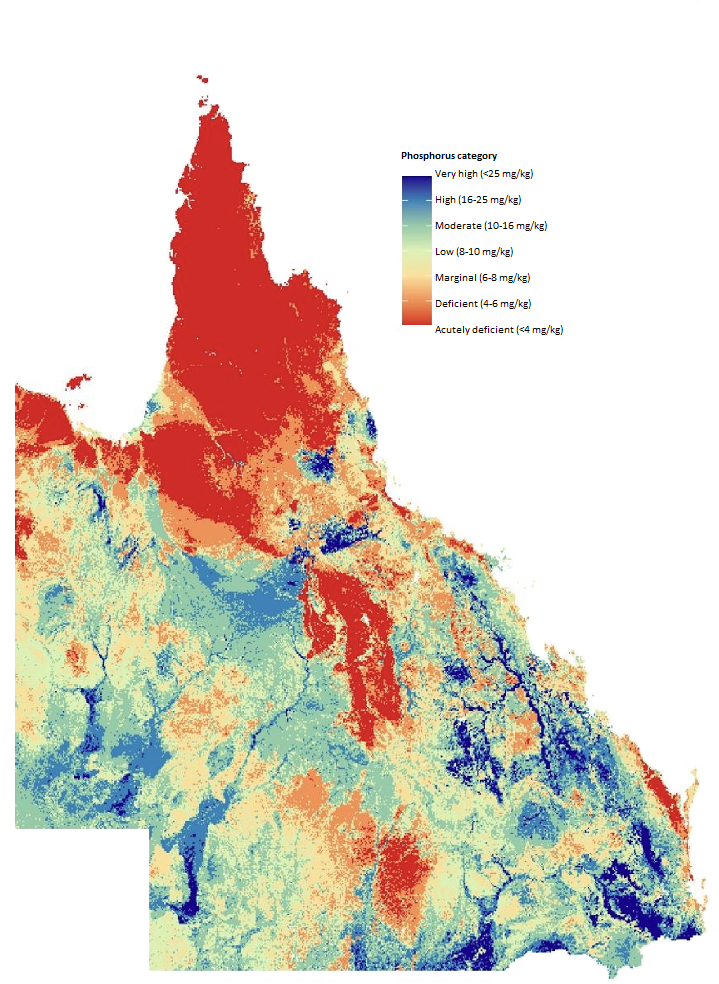
The Phosphorus Map of Queensland has now been updated to include the Gulf and Cape York regions of Queensland, where previously there was insufficient sampling data to produce high resolution mapping.
As livestock productivity in grazing lands is closely tied to the amount of plant available phosphorus (soil phosphorus), the map can be used to inform phosphorus management strategies for livestock, which can result in greater productivity and profitability.
The research for the soil phosphorus mapping was undertaken by Department of Primary Industries (DPI) and the Department of Environment, Tourism, Science and Innovation (DETSI) with funding support through Meat & Livestock Australia (MLA).
The updated mapping now provides producers with a high-resolution digital map of soil phosphorus information for Queensland through the FORAGE Indicative Soil Phosphorus report on the Long Paddock website.
To request specific soil phosphorus information for your property, go to the FORAGE Lot/plan request page. In addition to the soil phosphorus report, you will receive a GeoPDF file of the soil phosphorus map which can be uploaded to the Avenza maps spatial imagery app on devices such as tablets and mobile phones. A GeoPDF on your device allows you to match your location to the information you see on-screen.
A soil phosphorus webinar with presentations by DPI and DETSI is on Thursday 20 February from 12:30 to 1:30pm AEST. For more information and to register visit the FutureBeef event calendar.
For more information please contact Grant Stone on (07) 3170 5522 or email grant.stone@des.qld.gov.au.
For a summary of the ‘Phosphorus map of Queensland grazing lands’ project final report or to download the full report visit the MLA website.