New land type descriptions and mapping updates for SEQ
Work has recently been completed on the grazing land types of South East Queensland. The collaborative effort between Healthy Land & Water and Department of Primary Industry (DPI) scientists has improved the information and mapping accuracy available for landholders in this region.
A ‘land type’ is an area of grazing land with characteristic patterns of soil, vegetation and landform that are easily recognised by landholders in a region.
Land type descriptions not only outline the characteristics of land, but also their capabilities and limitations in producing useful forage for grazing. This in turn helps with assessing land condition and calculating carrying capacities for more informed stocking and management decisions. Land type information on the various regions of Queensland is available on the FutureBeef website.
Bruce Lord, Principal Scientist with Healthy Land & Water in collaboration with the DPI Grazing Science team have now completed the review of the Moreton and Southeast land type descriptions and mapping. Bruce is pleased to see the improvements, particularly to the mapping.
“Some areas in the Brisbane Valley were previously mapped incorrectly” says Bruce. “The recent changes provide a much better indication of what we’d expect to find in those areas.”
As a long-time extension officer and beef producer in the region, Bruce has been able to ground truth and provide valuable feedback to validate these changes.
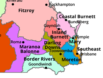
The two regions have been combined and will now be referred to as broader South East Queensland (SEQ) land types. These cover an area from Hampton north of Toowoomba, across to the Sunshine Coast and Hinterland regions down to the New South Wales border. The Mary region remains separate.
As a result of the review, three additional land type descriptions were developed (particularly relevant for coastal areas) bringing the total number of land types for the region to 15. The new land type descriptions created include:
- Gum-topped box open forest (SEQ04)
- Mixed open eucalypt forest on coastal plains (SEQ09)
- Paperbark (tea tree) forest on coastal plains (SEQ11)
The updated SEQ land type descriptions (including revised maps) are now available to view and download from the FutureBeef website. Landholders familiar with the former Moreton land type descriptions and mapping will also find a table showing how existing land types (MO) correlate with revised (SEQ) ones.
Until additional modelling work is completed the FORAGE indicative land type reports will still refer to the Moreton (MO) land types. The various FORAGE reports are available free via the LongPaddock website — a particularly useful tool when investigating unknown properties for agistment and purchase.