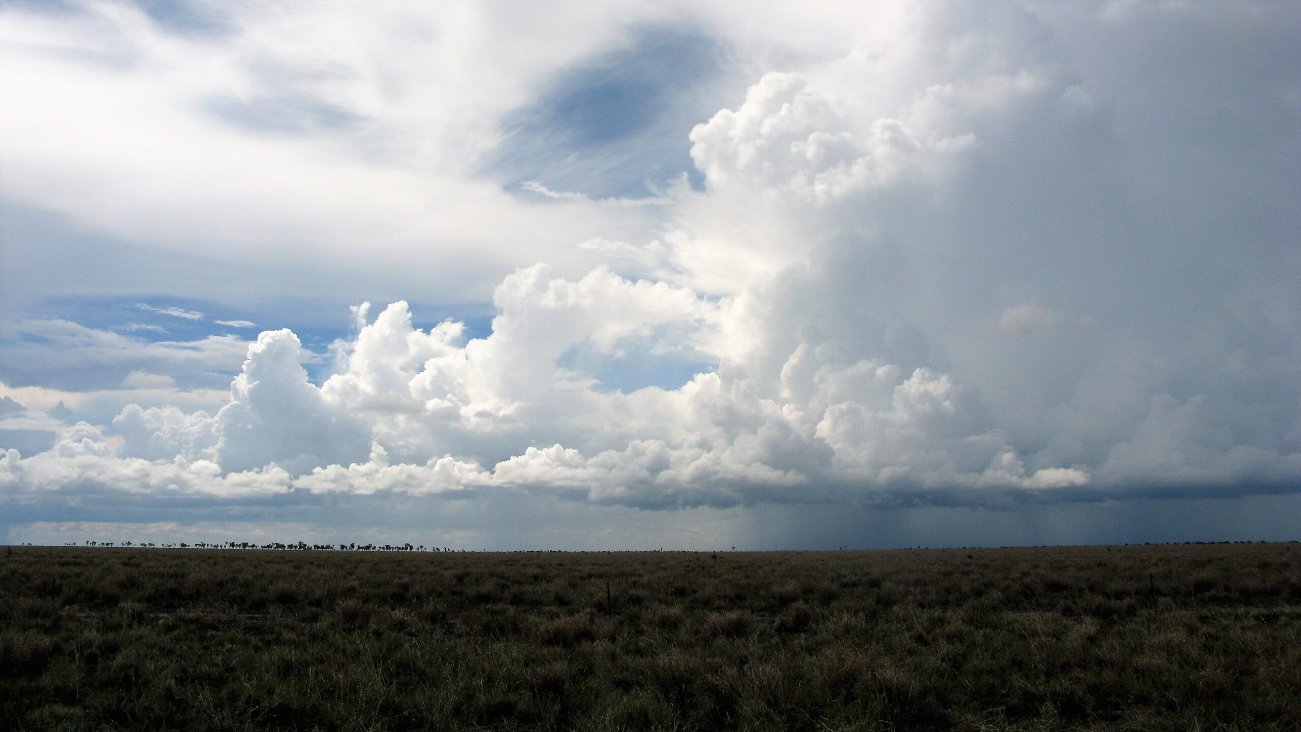
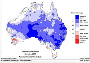
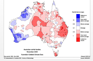
A tale of two La Niñas
 |  |
|---|---|
| November 2021 | November 2020 |
Generally a La Niña weather pattern in the Pacific Ocean heralds a chance of better than average rainfall over the spring and early summer season for the east coast, and northern areas of Australia. The Southern Oscillation index (SOI), which measures the difference in air pressure between Tahiti and Darwin, reflects what is happening with sea temperatures. A positive SOI gives a better chance of summer rainfall, and a negative SOI often indicates the possibility of a dry start to spring and a late break in the season with patchy summer rainfall.
So, what happened in 2020 to give many areas of coastal Queensland and further inland a very dry spring and summer season?
The Bureau of Meteorology has released a research paper that reviews the La Niña forecast for 2020.
The paper notes the following: Several compounding factors were identified as key contributors to the drier-than-anticipated spring conditions.
- Although the ocean surface to the north of Australia was warmer than normal, which would have acted to promote rainfall over northern Australia, it was not as warm as expected from its historical relationship with La Niña and its long-term warming trend.
- Also, a negative phase of the Indian Ocean Dipole mode, which typically acts to increase spring rainfall in southern Australia, decayed earlier than normal in October.
- Finally, the Madden–Julian Oscillation activity over the equatorial Indian Ocean acted to suppress rainfall across northern and eastern Australia during November.
- While ACCESS-S1 (the Bureaus forecasting model) accurately predicted the strength of La Niña over the Niñ4 region, it overpredicted the ocean warming to the north of Australia and underpredicted the strength of the November MJO event, leading to an over-prediction of the Australian spring rainfall and especially the November-mean rainfall1.
This information from the Bureau indicates the great number of factors that can influence our weather and how varying effects of climate drivers may lead to less accuracy in forecasts.
Unfortunately, many producers planted large areas of crop based on the November 2020 forecast and made other management decisions banking on a good wet season. These forecasts are based on probabilities and an 80% chance of above median rainfall means there is a 20% chance of below median rainfall.
The message for users of these long-term weather forecasts
- check updated forecasts regularly
- broad scale media alerts to wet or dry may not affect your location
- not all La Niñas are wet and not all El Niños are dry, especially when looking at monthly totals as opposed to three-month totals
- other weather influences can override the El Niño Southern Oscillation patterns in the Pacific
- Know the median rainfall for your location when using median forecast maps.
References
- Eun‑Pa Lim, Debra Hudson, Matthew C. Wheeler, Andrew G. Marshall, Andrew King, Hongyan Zhu, Harry H. Hendon, Catherine de Burgh‑Day, Blair Trewin, Morwenna Griffiths, Avijeet Ramchurn & Griffith Young. Why Australia was not wet during spring 2020 despite La Niña. Nature Scientific Reports Sept (2021).
This article has been written by Damien O’Sullivan, Senior Extension Officer (Department of Agriculture and Fisheries), with the assistance of Dr Chelsea Jarvis (University of Southern Queensland) and Matthew Wheeler (Bureau of Meteorology).