Managing grass from space
Are you using the free data available from: FORAGE and MyFORAGE, the Australian Feedbase Monitor, QLD Globe and Australian CliMate?
– written by Jo Gangemi, Department of Agriculture and Fisheries (DAF), Spyglass
Satellite imagery has revolutionized many industries by providing valuable data for informed decision-making. For graziers, satellite imagery has emerged as a powerful tool to monitor and manage extensive rangelands efficiently.
In today’s data-driven world, having access to accurate and timely information is a competitive advantage. Satellite imagery empowers you to make data-driven decisions, which can lead to better outcomes for your property and your bank balance.
Governments, policy makers, property selling agents and banks are relying on this data more and more, to inform their decisions both on a regional and individual property basis. The DAF Beef Extension team are here to help you understand what data is available about your property and how you can start using that data to support the decisions you make.
What data can you access?
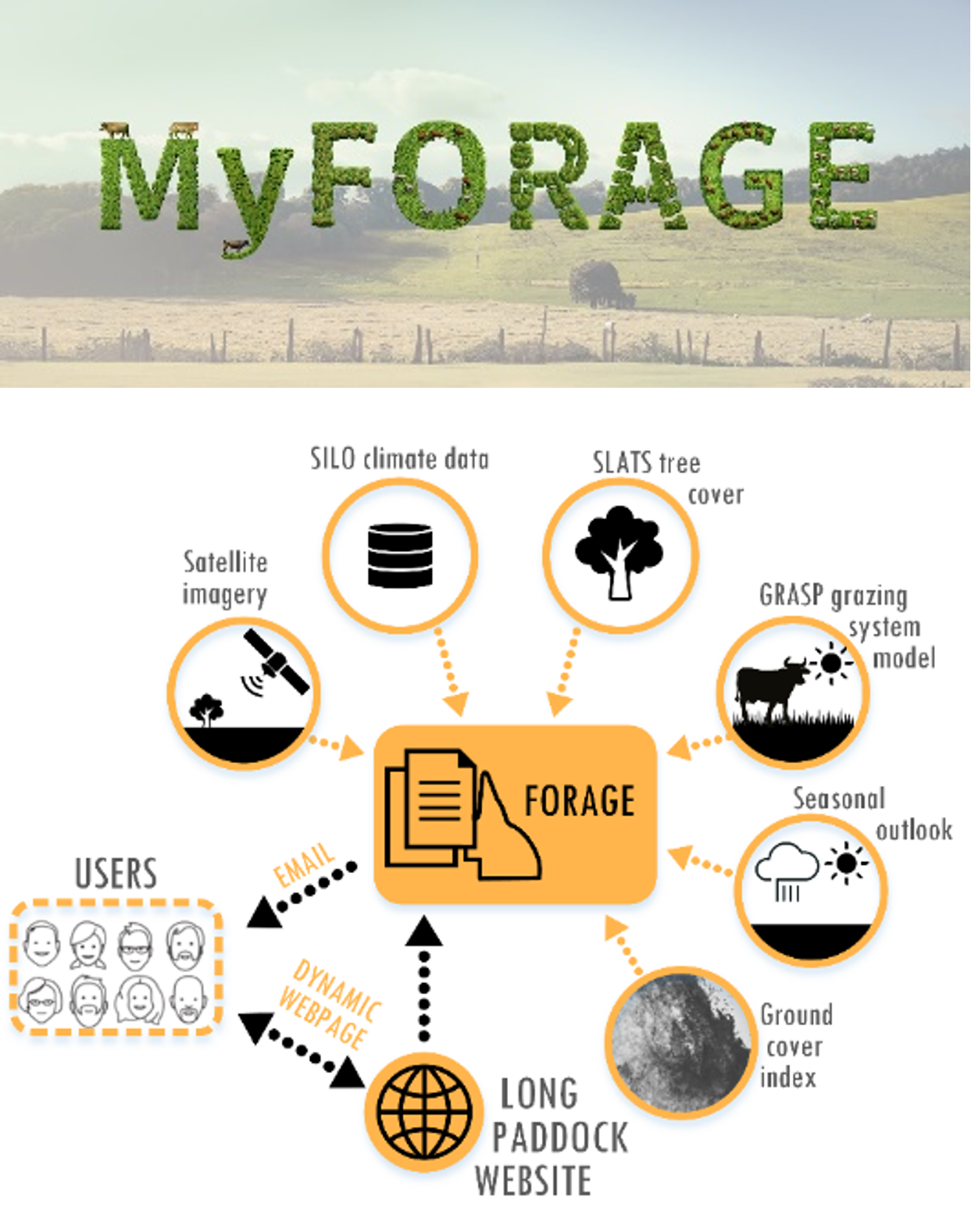
FORAGE and MyFORAGE
Found on the Queensland Government The Long Paddock website, FORAGE allows users to generate custom PDF reports based on rural Lots on Plan, or at a property/paddock scale, via MyFORAGE. Drawing on available data sets including climate data, satellite imagery and modelled pasture growth, the reports are designed to support decision-making in grazing land and environmental management.
Some of the reports available include:
- Indicative soil phosphorus report
- Ground cover report
- Rainfall and pasture report
- Erodible soils report.
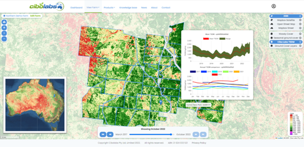
Australian Feedbase Monitor
Meat and Livestock Australia (MLA) have made the Australian Feedbase Monitor available for free for MLA members with a Livestock Production Assurance (LPA) account linked to their myMLA profile.
The Australian Feedbase Monitor allows producers to access monthly pasture biomass estimates specific to their unique Property Identification Code (PIC) and individual land parcels, with data dating back to early 2017.
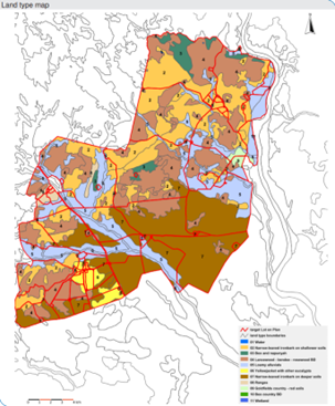
QLD Globe
QLD Globe is a free online interactive tool that provides users access to many layers of information, incorporating a mapping tool to allow users to build their own property map.

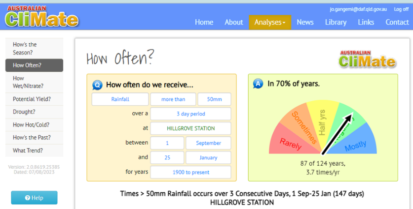
Australian CliMate
Australian CliMate is free decision support tool that allows you to track the season, calculate your green date and review historical weather patterns.
To start making sense of all this data and begin using it to support your decisions and even your finance applications or reviews, the DAF beef extension team are running a number of short online, interactive workshops.
Designed to provide an overview of these free decision support tools and an opportunity to ask questions, these workshops will be followed up with more intensive, single topic workshops if there is demand.
For more information contact Jo Gangemi on 0438 553 483 or jo.gangemi@dpi.qld.gov.au