Northern WA Twilight Forums assist pastoralists in preparing for a challenging season
Many pastoral leases across the Pilbara and Kimberley regions experienced lower than average rainfall and above average temperatures during the 2018/19 wet season, which resulted in extra pressure on the rangelands, livestock and water infrastructure, as well as on the staff who worked tirelessly to monitor and manage all aspects of the pastoral leases. Two cyclones late in the season brought some relief to localised areas in the Pilbara.
As part of the Department of Primary Industries and Regional Developments’ (DPIRD) response to the 2018/19 wet season conditions, the Northern Beef Development (NBD) team hosted a series of forums in early April on climate variability, forage budgeting and using satellite imagery to monitor rangeland condition and quantify forage availability.
“Twilight Forums” are NBD’s signature events; they are held on-station in the afternoon followed by a dinner to foster networking and discussion about the information presented. These short forums have been designed to provide timely access to relevant information and reduce producer downtime by being hosted on multiple stations across the region. Neighbouring stations within a three hour driving radius are invited to attend each event to allow a full morning’s work before the event kicks off at 2 pm.
Regretfully, the impact of Tropical Cyclone Veronica and the potential impact of Tropical Cyclone Wallace resulted in the postponement of two forums. Three forums were successfully delivered over six days in both the Pilbara and Kimberley, attended by staff from 13 pastoral companies which collectively manage over 3.9 million hectares.
Presenters at the workshops included Jardine MacDonald and Anne Marie Huey from the Climate Mate program, Col Paton from EcoRich Grazing and Phil Tickle from Cibo Labs.
Climate variability and available monitoring and management tools
The Northern Australia Climate Program (NACP) local extension officers, known as Climate Mates, Anne Marie Huey and Jardine MacDonald provided a brief, easily understood explanation of the four key drivers of seasonal climate in the northwest such as the Madden-Julian Oscillation, the Monsoon, the El Nino Southern Oscillation and the Indian Ocean Dipole. They also taught attendees how to read and find measures of these drivers on the BoM website. To learn more about these drivers and other climate forces check out Climate Kelpie. Understanding these key drivers and their indexes is important for reading seasonal outlooks as well as informing your own decision-making process.
In addition to BoM, some useful apps and websites such as CliMate, Long Paddock and ARM online were introduced, along with discussion of herd management implications of the current dry conditions and median outlook.
NACP Climate Mates are available across the north to connect producers to the NACP seasonal forecast and assist producers to further their understanding of seasonal climate forecasts.
Forage budgeting
With over 30 years of experience in research, development and extension in the grazing lands of northern Australia, Col Paton, EcoRich Grazing, discussed management strategies to improve land condition, carrying capacity and profitability.
As one of the lead presenters of Meat & Livestock Australia’s ‘Grazing Fundamentals EDGE’ workshop, Col delivered a snapshot of the popular course to participants, touching on climate variability, land types, land condition, grazing and spelling strategies, and short-term and long-term carrying capacities.
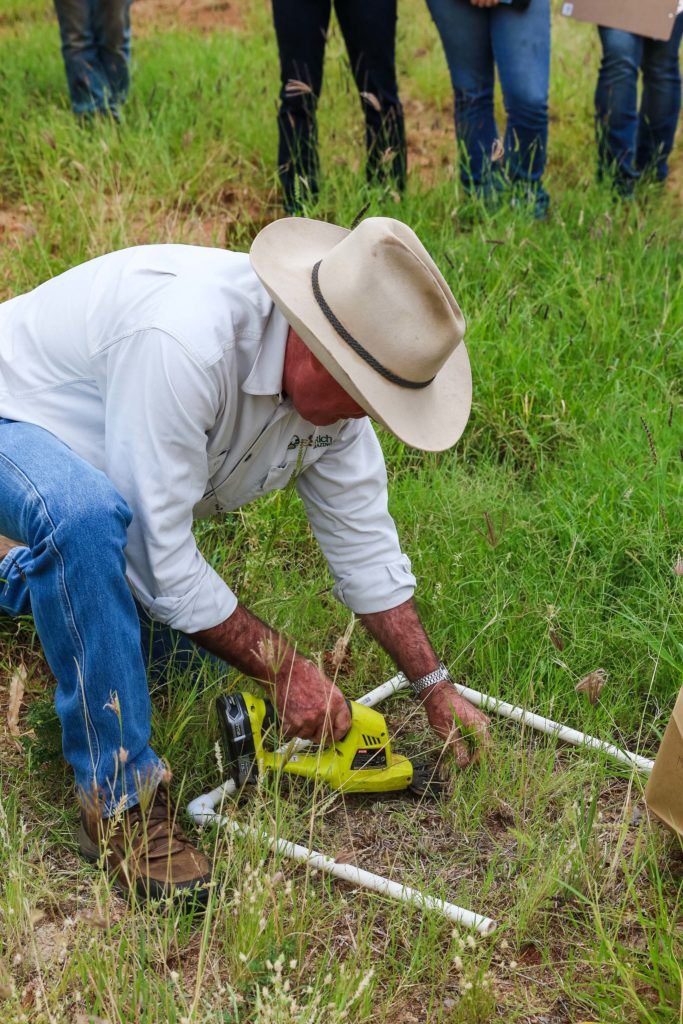
The session included a field walk to undertake a practical calculation of feed on offer. Participants were tasked with identifying pasture species and estimating the quantity of standing forage by using photo standards, before harvesting samples and calculating dry matter.
Col’s take home messages were:
Regardless of weather forecasts, make sure:
- your land is always ‘rain ready’ (good land condition and attached ground cover)
- you regularly monitor pasture, animal and land condition so that you can anticipate and avoid: feed shortages, diminished animal performance and land condition decline
- there is flexibility in your herd structure and grazing management to allow for timely adjustment of stock numbers.
Applications of satellite imagery in extensive pastoral enterprises
After manually calculating the feed on offer to manage carrying capacity, Phil Tickle from Cibo Labs presented on how satellite technology can be leveraged to answer questions such as: How many grazing days do I have?; How much green or non-green cover do I have?; Is my land condition improving or declining?
While the technology has been available for close to 30 years, Phil said a “silent revolution” had been taking place in the last 10 years with an increase in the frequency at which satellites capture data and the level of detail captured. Some satellites pass over as often as every five days and are able to capture 10 m resolution data—enough to see individual trees.
Satellite imagery can be used not only to assess pasture biomass, but the stage of growth, thus allowing land managers to monitor pasture response to weather events such as rain and heat waves.
The technology is complementary to traditional methods of forage budgeting and assessments, by being able to quantify pasture growth and consumption, allowing for a direct comparison with the predictions made through traditional forage budgeting methods. The accuracy of visual assessments made out in the paddock can be measured against data collected from the satellites. However it was highlighted that the technology cannot be used as a replacement for visual assessments in the paddock.
Satellite imagery can also be used to demonstrate development potential to financial lenders as imagery showing unutilised country can be used to demonstrate a business case for water point development.
The ability to monitor land condition not only for internal business management, but to also demonstrate positive stewardship to the broader community was heralded as a major opportunity of the technology.
While there are a number of opportunities available from the use of satellite technology, pastoralists are encouraged to undertake a benefit-cost ratio analysis to understand the benefits applicable to their specific enterprise.
Managing for the challenging season ahead
FutureBeef has a number of resources available online regarding managing for climate variability and forage budgeting, including how-to videos, a recorded webinar, guidelines and general rules of thumb.
For more information on the Grazing Fundamentals EDGE course, visit mla.com.au/extension-training-and-tools/edge-network-hub/
Additional information about the northern WA beef industry
The Pilbara and Kimberley regions cover approximately 1 000 000 km2, or 40%, of Western Australia’s land mass. There are approximately 900 000 head of cattle in the regions; 30% in the Pilbara and 70% in the Kimberley. The majority of young cattle are turned off into the live export market, with a smaller percentage entering southern supply chains for backgrounding and slaughter. Cull females and males enter the domestic meat processing market.
The Kimberley region has some of the largest pastoral stations and herd sizes due to its relatively reliable rainfall (tropical climate) and sustainable native pasture base. By comparison, the Pilbara region consists of large areas of shrublands and receives both summer and winter rainfall (a semi-arid climate), though neither is reliable. Consequently, the Pilbara region observes a more conservative stocking rate than the Kimberley.