The Drought Map Sequence viewer now available from Long Paddock
Viewing current drought status or retrospective maps (for Queensland) has been possible for some time by visiting the “Drought Declaration” page on the Long Paddock website. However, there is often an interest in the contributing factors that are associated with the evolution of a drought situation (i.e. rainfall, pasture growth). Therefore, additional information about current and past factors that impact on regional areas can be helpful in understanding drought conditions.
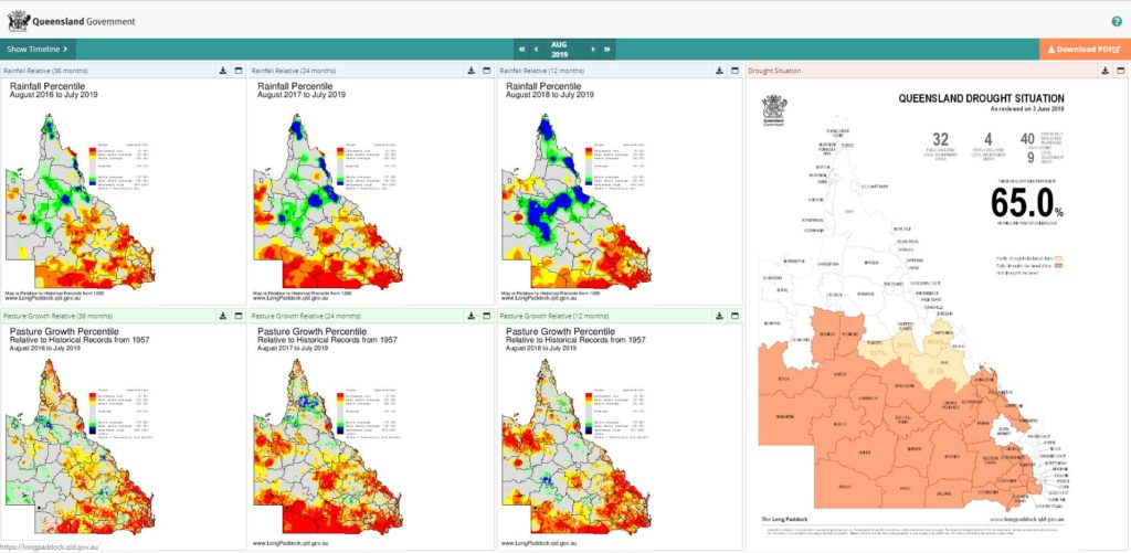
The new Drought Map Sequence Viewer (DMSV) provides arrangements of drought maps along with the suite of AussieGRASS maps for analysing and better understanding current and past contributing factors to the current seasonal conditions (e.g. for drought declaration and revocation). There is one standard screen which relates the most recent drought situation map, along with rainfall and pasture growth percentile maps (for the previous 12, 24 and 36 months). Alternatively, the DMSV can be user defined to select another time period, plus other variables (e.g. soil moisture, runoff), with different time sequences (i.e. monthly, annually). If required, the map selection can then be saved as a PDF document for printing, emailing or presenting.
The Drought Map Sequence Viewer is a useful tool to better understanding drought sequences and conditions, especially for assisting in declaration and revocation activities. It can also be used for funding applications, reporting purposes and education activities. The DMSV can used for other Australian states and territories to display the sequences, however, the drought situation map will not appear for non-Queensland views/selections. The viewer can be accessed from the Drought Declaration page on the Long Paddock website.