Upgraded satellite imagery improves fire scar reports
Property owners now have access to higher resolution fire scar mapping thanks to a recent upgrade in satellite imagery. Principal Extension Scientist, Grant Stone, said he was excited by this latest product development provided through the FORAGE decision support system.
“The FORAGE suite of property reports have been accessed by users for over a decade, with constant improvements. This latest upgrade of satellite imagery allows us to provide improved information on historical fire scars from 2019 to current to detect smaller fires and fires that occurred under tree canopies,” Grant said. “The new Sentinel imagery is higher resolution (approximately, 10 x 10m), whereas the NOAA imagery used for reporting fire scars (1992 to 2018) is at a much larger scale (approximately, 1 x 1km).”
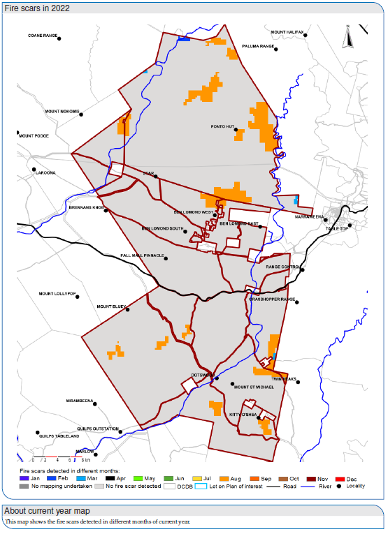
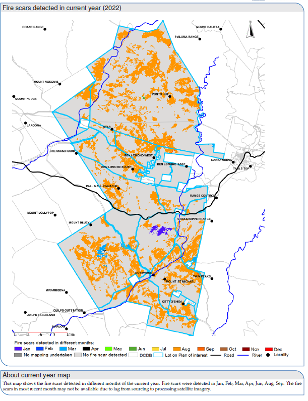
“Fire Scars help you appreciate the adequacy of fire frequency for woody plant maintenance,” Grant continued. “It could also assist monitoring of carbon farming activities, assess bushfire risk and monitoring fuel load build-up in woody areas.”
The improved fire scar report is available now and for free, from LongPaddock.qld.gov.au/FORAGE/