
FORAGE is an online decision support system that generates and distributes information for rural Lots on Plan greater than one hectare for grazing properties in Queensland.
The reports generated by FORAGE incorporate a number of products such as SILO climate data, satellite imagery and modelled pasture growth, delivering them by email as easy to understand PDF property-scale reports, to help decision-making in grazing land and environmental management.
Download a two-page FORAGE Quick User Guide, or for more detail, see the full FORAGE User Guide on the side panel.
Available FORAGE reports include:
Long-term carrying capacity
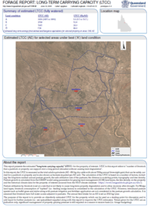
Long-term carrying capacity information can help with planning for property improvements, estimation of long-term herd numbers, property purchasing and selling decisions and determining changes in carrying capacity associated with changes in land condition.
The FORAGE Long-term carrying capacity report provides an objective estimate of the number of livestock that a property will run safely for “A” through to “D” land condition, around which seasonal stocking rates can be adjusted.
Click here for more information.
Pasture growth alert
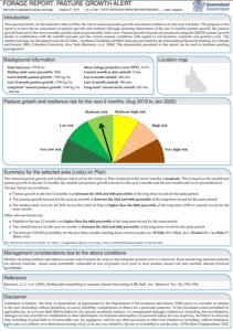
The FORAGE Pasture growth alert is a four page report that provides an assessment of future pasture growth and pasture resilience risk, thereby assisting in management decisions to increase property resilience to drought and help identify pasture recovery opportunities.
Ground cover report
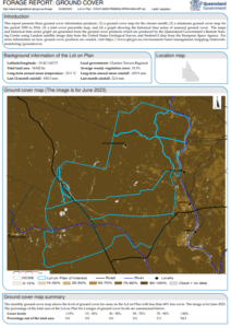
The FORAGE Ground cover report now offers a monthly satellite map for your property. Now, around the tenth day of each month the page one map will display an image from the previous month, showing a range of ground cover classes for property assessment.
This report previously used seasonal (three month) imagery, which was often not available until well into the following season.
Fire scar report
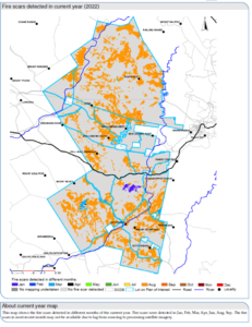
Order the latest FORAGE Fire scar report available from the Long Paddock website.
You can see the fire frequency on your property for the past 10 years, to find out whether it has been burnt too much – or not enough, what months fires have occurred and where.
To find out more about the FORAGE Fire scar report, click here.
Indicative land type report
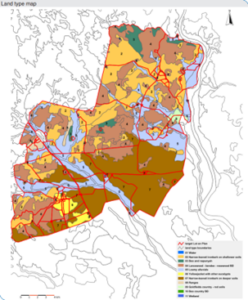
The FORAGE Indicative land type report shows the current version of Grazing Land Management land type mapping (updated February 2019) and the approximate area of each land type with the selected area. Land types are areas of grazing land with similar soil, vegetation and capacity to produce useful feed.
The FORAGE Indicative land type report shows the location, size and proportion of land types within a selected Lot(s) on Plan.
To read more, click here.
Rainfall and pasture report
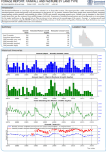
The FORAGE Rainfall pasture by land type report provides historical rainfall, pasture growth, total standing dry matter and pasture cover information for a selected Lot(s) on Plan by Grazing Land Management land type.
Rainfall is estimated (by interpolation) from surrounding rainfall stations, pasture cover from satellite imagery and modelling, and pasture growth from modelling alone.
To find out more about the FORAGE Rainfall and pasture report, click here.
Drought duration report
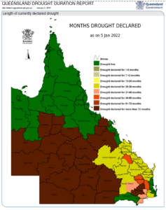
The FORAGE Drought duration report shows the current drought situation and summarises the historical drought duration information in Queensland.
This five-page report features information regarding the months drought declared, months without drought, percentage time drought declared since 1964, and more.
Get the current Drought declaration report from the Long Paddock website.
In addition to the customised reports, the Queensland Government has created a number of short animated videos and recorded many explanatory webinars. To request any FORAGE reports, click here.
Recorded webinars
FORAGE reports for assisting land management decisions
Grant Stone (Principal Scientist with Department of Environment and Science) discusses the growing field of satellite imagery and the sorts of tools available from FORAGE.
Playlist
- FORAGE reports for assisting land management decision-making
- Outline
- So how do our products assist?
- Long Paddock website delivery portal
- FORAGE property reports
- DES’s Remote Sensing Centre (RCS) provides…
- Combining the major aspects of climate, pasture and grazing environment
- The reports – briefly
- I. Indicative Land Type report
- II. Rainfall and Pasture report
- III. Drought Assessment report
- IV. Regional Climate Projections report
- V. Erodibility report
- VI. Foliage Protective Cover report
- VII. Crop Frequency and Type report
- VIII. Fire Scar Map report
- IX. Ground Cover Map report
- X. Ground Cover Regional Comparison report
- XI. Pasture Growth Alert report
- Using reports for productivity – how to interpret them
- Requesting FORAGE property reports
- Who uses FORAGE?
- Long Term Carrying Capacity report
- My FORAGE on-line property mapper
- Pasture Biomass estimates from satellite imagery
- VegMachine – Four seasons of Fractional Cover
- Pasture digestibility (DMD) impact on animal liveweight gain
- Common industry questions
- Forecasting liveweight gain (ADG)
- Some final words…
FORAGE – free property information to assist with Grazing Land Management decisions: Part 1 – currently available information
The Queensland Government’s Long Paddock website offers a suite of free FORAGE online property-scale land management reports. These reports have been designed to support those involved in Queensland (and Australian) agriculture to support decision making in grazing land management including graziers, extension practitioners, consultants, researchers and education providers.
In this presentation, Grant Stone (Principal Scientist with the Queensland Department of Environment and Science) discusses:
- what reports and information are currently available;
- how to access and order reports for your property; and
- provides a preview of the new and soon to be released reports.
Download a copy of the FORAGE – free property information- part 1 – currently available information (PDF, 5MB)
Playlist
- Forage – free property information to assist grazing land management decisions – Part 1: currently available information.
- Webinar ‘roadmap’
- What is FORAGE?
- FORAGE data sources: SILO Climate database
- FORAGE data sources: Grazing system models
- FORAGE data sources: Remote sensing data
- FORAGE support
- Common land management questions
- Rain and pasture report
- Indicative Land Type report
- Rainfall and Pasture by Land Type report
- Rainfall and Pasture Growth Outlook report
- Foliage Projection Cover report
- Ground Cover report
- Ground Cover – Regional Comparison report
- Drought Assessment Information report
- Erodible Soils report
- Regional Climate Projections report
- So, who uses FORAGE?
- What FORAGE products do I use in regard to land management questions?
- Wrap-up
FORAGE – free property information to assist with Grazing Land Management decisions: Part 2 – new and soon to be released reports
New reports are now available for the FORAGE suite of online property-scale land management reports. The Crop Frequency and Type report and the Fire Scar report have been recently released and can be accessed on the Queensland Government’s Long Paddock website.
Two additional reports: The Pasture Growth Alert report and the Estimated Safe Carrying Capacity report are being developed for release.
In this recorded webinar, Grant Stone (Principal Scientist with the Department of Environment and Science):
• introduces and explains the newly released Crop Frequency and Type and Fire Scar reports; and
• provides a preview of the soon to be released Pasture Growth Alert report and Estimated Safe Carrying Capacity reports.
Download a copy of the FORAGE – free property information – part 2 – new and soon to be released reports (PDF, 7.7MB).
Playlist
- FORAGE – free online property information to assist with grazing land management decisions: Part 2 – new and soon to be released reports
- Webinar roadmap
- The FORAGE system
- Crop Type and Frequency report (10 year crop frequency and crop type information by season)
- Crop Type and Frequency Map reports (by crop frequency, season – summer/winter, grain/cotton and pulse/cereal)
- Crop map images – Summer (February) and Winter (September)
- Fire Scar report (page 1 – background information)
- Fire Scar report (page 2 – years since burnt and page 3 – fire scars detected in each month)
- Fire Scar report (page 4 – time series graphs for the number of fire scars by month [historically] including fuel load and curing index)
- Fire Scar percentage area graph and rainfall pasture report (identifying low burn areas, high burn areas and biomass)
- Pasture growth alert reports (prototype – background information and report layout)
- Pasture Growth history (page 2 – moving 12 month period)
- Pasture Growth accumulation outlook (page 2 – 6 month pasture growth outlook)
- Pasture Growth total cover (page 3 – seasonal total cover)
- Rainfall and pasture growth maps (page 4)
- Safe Carrying Capacity report (prototype)
- What information is used to calculate Safe Carrying Capacity?
- Safe Carrying Capacity results and outputs
- Safe Carrying Capacity report – it’s progress for release
- ‘My FORAGE’ mapper (prototype – what is it?)
- How do I request FORAGE property reports?
- Your subscription options for selected reports
- FORAGE support
- Summary of new FORAGE reports
- Wrap-up
Resilience strategies for small landholders: Drought plans and maintenance feed requirements for cattle
This recorded webinar is focused on supporting small landholders during times of drought and the subsequent recovery processes.
In this recording, Roger Sneath (Senior Beef Extension Officer, Department of Primary Industries) discusses the development of drought plans and the concept of having a strategy in place when faced with the challenges of dry conditions.
At what point do you make important decisions about the animals in your care?
Roger will also expand on what cattle feed requirements (for maintenance) you should consider when making these decisions. The topics discussed include:
- Rain and pasture websites
- Review drought plans
- Feed budgeting
- Drought options and tools
- Feeding cattle
- Holding breeder condition
- Protein and energy supplements
- Costing nutrients
Download a copy of the presentation – Dry season management (PDF, 2.53 MB)
Additional resources:
- a new website has been developed to support small landholders – ‘Animals in drought‘
- information on Dry season pasture budget: a guide for stocking rates (FutureBeef)
- information on Forage budgeting videos (FutureBeef)
- information on Beef business tools (FutureBeef)
- information on Dry season management of beef businesses (FutureBeef)
- information on Managing for dry years and drought (FutureBeef)
- information on drought and climate adaptation visit the Long Paddock (FORAGE) website
Playlist
- Dry season management
- Topics to be covered
- Australia’s variable rainfall
- Long paddock website and FORAGE
- CliMate website
- Drought decisions and review
- Making a drought plan
- Producer reflections on drought…
- Annual cycles and critical trigger dates
- Feed budgeting
- Drought options and tools
- Selling vs feeding
- Managing for variability
- Feeding cattle – how much do they drink?
- How much do they eat?
- Maintenance full hand feeding rates (as fed)
- Weaning information
- Estimated full feeding costs (425 kg breeder)
- Holding breeder condition
- Protein and energy supplements
- Costing energy and protein
- Fodder biosecurity (chemical, weeds, etc)
- Summary and take home messages
Resilience strategies for small landholders: Grazing land management and pasture recovery
This recorded webinar is focused on supporting small landholders during times of drought and the subsequent recovery processes.
In this presentation, Bruce Lord (Healthy Land and Water) discusses the factors relating to grazing land management and pasture recovery including:
- Land types
- Soil health
- Grazing land condition
- Pasture and grass indicator species
- ABCD land condition scoring
- Grazing management tools
- And many more…
Download a copy of the presentation – Grazing land management and pasture recovery (PDF, 3.92 MB)
Additional resources:
- a new website has been developed to support small landholders – ‘Animals in drought‘
- watch this short (1 minute) video on ‘Why you need groundcover’ (1:14; published 29 November 2016 by FutureBeef)
- watch this video (5 minutes) on ‘Guide to pasture photo monitoring’ (5:14; published 27 April 2020 by FutureBeef)
- information on Dry season pasture budget: a guide for stocking rates (FutureBeef)
- information on Forage budgeting videos (FutureBeef)
- website Long Paddock (FORAGE)
Playlist
- Resilience strategies for small landholders: Grazing land management & pasture recovery
- Grazing land management
- Land types and soils
- Land types affect pasture growth
- Soil health – functions and properties
- Soil health – plant available water content
- Soil health – nutrient availability
- Soil health – soil organic matter
- Soil health – groundcover management
- Managing soil limitations and at-risk areas
- Grazing ecosystem – Three gateway model
- Grazing land condition
- Features of a healthy pasture
- Some pastures and grass indicator species
- ‘ABCD’ land condition scoring
- Land in ‘A’ good condition
- Land in ‘B’ fair condition
- Land in ‘C’ poor condition
- Land in ‘D’ very poor condition
- The rolling ball – land condition
- Land condition affect pasture growth
- Maintaining land in good condition
- Land condition – the drivers
- Pasture and land condition resilience
- Grazing management tools
- Long term carrying capacity Vs Stocking rate
- Forage budgeting (balancing supply and demand)
- Safe utilisation rates
- Rest – a critical time is key
- Managing the grazing system
- Management of land types and soils
- Maintaining pasture and land condition
- Restoring pasture and land condition
- Resources
Videos
FORAGE long-term carrying capacity report
How FORAGE can help land management
This short video introduces the FORAGE land management information system and shows how you might apply FORAGE to your grazing land management decision-making.
How FORAGE can help with livestock body condition
This video discusses the importance of pasture quality and quantity in maintaining the body condition of your cattle for breeding, growing and finishing.
FORAGE rainfall and pasture growth reports provide information that may be helpful in determining whether your paddocks can supply enough pasture to maintain body condition of your cattle.
How FORAGE can help with agistment
This video discusses the questions you might ask when you are considering suitable areas to agist your cattle.
It highlights the FORAGE report/s that provide useful information about growing seasons, pasture growth and quality, and water availability.
How FORAGE can help manage stock and pasture
This video discusses four key FORAGE reports that can help you to assess and manage ground cover and land condition on your property.
Understanding percentiles in climate data
The Pasture Growth Alert report—the latest addition to the FORAGE suite
The FORAGE Pasture Growth Alert report is a four-page report that can assist with stocking rate decisions, grazing land management, and drought preparation, by providing a rating on past and future pasture growth.
This video gives a brief overview of the Pasture Growth Alert report – for a more in-depth tutorial on how to use the report, continue watching through until the end of the video.
Share this resource via
